At work we have just been given personal usage of our company vehicles. This meant that I loaded up the truck will all of my camping gear, and headed out immediately after work. By heading out I mean that I went to 7-11 to get a slurpee... and then I headed out.
We did not know who would get there first. Chloë was leaving first, but she was leaving from Invermere and a massive crash closed down Highway 93 South adding an hour to her drive. Becky and I ended up leaving at about the same time, but she left from Calgary, and I left from Drayton Valley. Really, we all just headed into Jasper National Park with the hopes of meeting up with each other... eventually...
It was a beautiful day and a beautiful drive. It was clear for the first bit, and then as I reached the Bighorn Dam there was a little rain and then something very interesting. It was precipitation from the sky no doubt, but it was not really rain. I drove through some kind of mist... but it wasn’t mist... it was like a zillion tiny little droplets of water. For those of you who know a thing or two about the refraction of light through water you might guess that this was the perfect conditions for a spectacular rainbow.
A Crystal Rainbow
The Most Biggestest Rainbow Ever
Stuck between a Rock and a Hard place...
We left two of the cars at the campground and then drove the fiveish minutes to the Icefield Centre. I have never been to the Columbia Icefields before, and even as we drove up it was hella impressive. You drive to this rather large building in the middle of nowhere, and directly across from it you look at the Athabasca Glacier as it spills out of the Icefields and down the mountainside. Impressive.
Snow in the Ice Fields
The Mighty Athabasca
We went in to the Centre briefly and snagged some tickets for the Ice Explorer trip. Without having to wait at all we were ushered onto a bus that headed up a lateral moraine/big pile of dirt towards the staging area for the Ice Explorers. The driver on the bus explained to us that the trees were tiny up here because of harsh conditions (until we hit the treeline and there were no trees at all), and that on the side closest to the glacier there were no branches because of nasty ice wind/dust/stuff that blew off of the Icefields. It was a good tour, and a good start to our adventure on the ice.
ATV
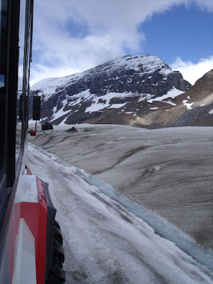
The bus took us to the staging area for the Ice Explorers, which are all terrain buses with six ginormous wheels. In one of those we headed down onto the Athabasca Glacier. It was kind of fun to be sliding forwards in your seat as the Ice Explorer crawled down a steep incline, and then to have your faced pressed against the glass as it drove onto a road carved into the glacier. We were taken far on the glacier to a cleared off circle for people to walk around. We could have walked outside of the circle but that may very well have resulted in a long drop and a very fast freezing if one of us fell into a crevasse. We read about the crevasses (cracks) in the ice where people had fallen and died. A few years ago there was a child who fell down. Long before rescuers made it to them, the child had already died of hypothermia... so... long story short... we stayed in the safe zone.
Our Guide
The Athabasca Glacier (Windy)
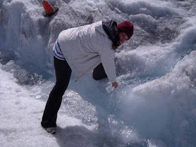
We had twenty minutes to wander around on the ice... and that is what we did. We filled our bottles with water melting off of the glacier and generally just had a good time. I had an interesting experience when we were wandering on the ice. The guide from another Ice Explorer said “Can I call you Jayne?” I did not hear him, so Chloë grabbed me and turned me around. “Can I call you Jayne?” He repeated. It took me a moment to realize what he was talking about, but then I remembered the hat upon my head. It is Jayne’s hat (Jayne from Firefly... his mom mails it to him... so amazing... distinguished) that Chloë made for me. We had a lovely chat about the hat, and about Firefly, and then it was time to get back on our Ice Explorer to head back down from the glacier.
Me and the Icefields
Jayne, the Hero of Canton
Jayne's Song
Getting a Drink (Windy)
We made it back safely and looked around the Icefield Centre a bit. After that we drove to the toe of the glacier where we were able to walk around. Now, I would not dare walk on the glacier without a guide, but walking on the ground up to the glacier... that is my kind of thing. There might have been a little fence in my way, but really, as soon as you step over it you can’t see that you have crossed the line. Becky and I headed down to the toe for some photos and some looking around while Chloë covered our backs.
The Toe of the Athabasca Glacier
The Head of the Athabasca River
Slowest game of Chicken ever...
Inukshuk
The Toe of the Glacier
Under the Ice
Having our fill of out of boundary fun we headed back to the car and were on our way. We got the cars from the campground and then headed south towards the Kootenay Plains. We stopped for some photos along the way and then at Saskatchewan Crossing to see what was there (mostly just inflated prices btw). From Saskatchewan Crossing it was just a few minutes to get to the Kootenay Plains, and from there it was just a few minutes to get to our new campground, Two O’Clock Creek.
Black Bear!
We found a spot, went through the routine of setting up camp again, and then Becky went about starting a fire. It was dry that day so she had few issues in getting a good little blaze going. There we had a late lunch... chip sandwiches... hot dogs... etc...
There was still some time in the day so Chloë and I wanted to go off exploring. Becky tended to the fire and camp whilst Chloë and I headed up the mountain to try and find Two O’Clock Creek.
Nature's Bridge
Two O'Clock Creek
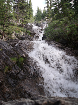
It turns out that Two O’Clock Creek was like a two minute walk from the campsite but we headed in the wrong direction. Two O’Clock Creek is also quite tiny. Where we headed it took us a long time to find anything but when we did it was a raging creek, roaring down the mountain. There were also all sorts of wild berries about that I would have pilfered were they ripe. On the way up to this fantastic place we also walked through an incredibly serene forest that I swore could have been home to a Unicorn... something like the Unicorn that this gentleman saw in Banff...
Unicorn Forest
The Path to Rivendell
It was getting late so we headed down from out Two O’Clock Creek adventure and back to the camp. When we arrived the fire was still roaring and everyone was ready to relax. Since we were just sitting around the fire I put the crew to work making Tsubas. A Tsuba is a handguard for a sword. I was making some leather ones for training swords, and it helped to have some extra hands. We sat around, stitched, and just had fun.
After my assembly line unionized and shirked their responsibilities we had another fantastic supper over the fire... mmm... bologna on a stick...
Another half-decent sleep in the tent and then another morning. We had breakfast. We packed up the tent. We were off. Two O’Clock Creek is only like one kilometre from the Sifleur Falls staging area so we weren’t driving long. We parked the cars, grabbed what we needed for the hike, and then were on our way.
The Kootenay Plains
I like the Kootenay Plains. In general I think it is just a very interesting area. Usually I am just driving through, so I enjoyed every moment as we wandered down the trail towards the falls. We passed over the North Saskatchewan River and then came to the Sifleur River. The path continued along it as the river sank further and further away into a great canyon. Interesting story... my parent’s first met on a camping/hiking trip to Sifleur Falls... I wonder if it looks much different now.
Start of the Fall
We made it to the falls and wandered around quite a bit. The water looked quite refreshing but was too fast for a swim... also Chloë stuck her feet in and evidently the water was supa’ cold since we were so close to its source in the Icefields.
The Path Home
We wandered back to the cars and made ourselves a plan for the rest of the weekend. I told the ladies that they should at least drive far enough to see the Bighorn Reservoir, as it is mighty. Becky was heading that way anyways, and Chloë decided to come along. We drove east and stopped to take a few photos. Chloë and I climbed that island that I have climbed before while Becky took some photos at its base. From there we decided that we should continue to Nordegg since it wasn’t far and we could get some lunch.
Plates of Stone
I have not gone into Nordegg before and I know little about it. Turns out that it was once a booming mining town, and now it is not so much. I think that a large chunk of the town is a ghost town, as we saw signs for it, and you can definitely get a tour of the abandoned mine. I will go back later when I have time to investigate. On this trip we did not have that luxury. We stopped at a rock shop, and then went to the museum for lunch. We did not explore much but we had an amazing lunch at reasonable prices (hint hint... if you go to Nordegg go eat at the museum). Becky bought some swag at the store and then we adjourned lunch and this fantastic weekend.
Chloë headed back to Invermere. Becky headed to Sylvan Lake and then Calgary. I headed north back to Drayton Valley and then Rocky Rapids. I wasn’t sure I had enough fuel to make it... but I was pretty sure. Turns out I made it to Drayton with the fuel light on. Perfect timing.
It was a fantastic drive up through the Indian reserves, but I am sad to say that one of the horses that I saw wandering around on the road a week or two before had been struck by a car and that he wandered no more. C’est la vie.
It was another amazing weekend, as they always seem to be, full of adventure, pain, and pain killers — the three cornerstones of my life.
Ye haw!


ps my hat way cooler cause its a panda and has matching mitts
ReplyDelete