Becky, Chloe, and I met up in Calgary in the afternoon on the Friday and then drove out to Bella Vista. We got in late and spent the rest of the night packing our backpacks. We went to sleep and then woke early the next morning to the smell of bacon and eggs. Dad wanted to make sure that we had a good meal in us before we headed into the mountains, and he surely succeeded.
Ready to Go
We loaded the packs into the Jeep, filled up on fuel, grabbed slurpees, and were on our way. We knew where we were going... mostly... so we set to it. We did get lost once, as we always do, but with the aid of Chloe's Dad's GPS (with backroad maps) we were back on route in no time.
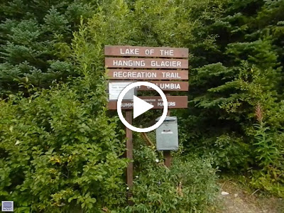
It was a 50 kmish drive to the trailhead and it took us about an hour and a half. It is amazing what there is back on back roads, and we drove past incredible ranches, and though beautiful valleys. We found the trail head and were good to go. I will mention that we also drove past one sign on the way in... the sign said that the bridge was washed out...
We went to the check-in box and read the reports from other hikers. In every case they reported that the bridge was still usable. Excellent.
We threw on our packs and headed down the trail...
So tired... I mean excited!!!
En Route
En Route Again
Lean
On the Mountainside
Leaning Over the Creek
An Old Road
Up the Mountain
False Horsethief Falls
Crossing
Down the Falls
Up the Falls
Trickle
The Real Horsethief Creek
Washed Out
Horsethief Creek
Across the Washed Out Bridge
Across the Bridge
Across the bridge and then up up up. The trail followed the creek, and then as the creek turned into the waterfall that must have been at least a zillion metres long the trail switched back and forth up the mountain. We had heard that there were thirteen switch backs, but we had an issue where we didn't know the definition of a switch back. Was that thirteen corners? Thirteen legs one way? Or thirteen legs both way? Ef.
We kept going. Up. Up. Up.
Glacier up the Valley
Natural Bonsais
Horsethief Falls 1
Tiny Trees on Horsethief Falls
The Haladies
Horsethief Falls 2
Two Falls
180 of the Wilderness
Eroded Roots
The Path
Glacier
8 km hike... something like 800 m vertical... our shape... soggy... yeah... crap. The hike was harder and longer than we had anticipated. We had wanted a challenge, but this was borderline too challenging for our current physical condition. For those of you who don't know I have bursitis and condromalacia patallae in my left knee, which translates to tendinitis and cartilage damage. I was carrying a tent, my gear, and a boat... evidently my injured knee didn't like this. I started favouring that leg, and then as my other side over compensated the tendons on that side also began to ache (I suspect I have tendinitis and/or cartilage damage in both knees). By the time we were getting to the top I was in severe... severe... pain. The girls took the boat as we tried to make it.
The hikers we had seen going up were on the way down and they tried to give us some hope... they said we
were close.
Tiny Creek
Beam Bridge
Nature
We didn't make it all the way to the lake, but we made it to the campsite. We saw the benches made of logs and the firepit made of stones. We dropped the gear and all collapsed. We were at the treeline. We could see up the rocks, and only a few hundred metres away we knew there was the lake.
Arrival at Lake of the Hanging Glacier
Where We Came From
Slightly recuperated we headed down to Horsethief Creek/Falls to get some water. The ladies filtered some water (I wanted to drink it straight but they didn't want beaver fever), while I iced my knees. This might seem a bit crazy to some, but the burning in my knees was severe and I was starting to get worried that I wouldn't be able to walk the next day (as was the case when I initially injured my knee). I threw on my swim trunks and slid into the water, dangling just my knees... At first I could only feel fire. The water coming straight out of the glaciers was so cold it burned, but then, then the fire subsided and I felt just the cool of swelling control. I would have stayed in there for ages but my toes were going numb and I was concerned about getting frostbite.
Getting Water
Icing Myself...
Camping at Lake of the Hanging Glacier
Dessert
Our Tent
The Toilet
The Falls
Waterfall
Violet Flowers
The Path Back Down
Incredible. The mountains form a bowl (including the famous Jumbo), and along the rim rest many glaciers. The glaciers melt and that runoff forms the lake... the Lake of the Hanging Glaciers. We walked to the shore over a strange ground of rocks were the water was running below us, and then we inflated the boat.
360 at the Lake
Drainage
At the Lake of the Hanging Glacier
Balance
Enjoying the Lake
Some of the Many Glaciers
Crossing the Rocks
An Old Camp Site
I wanted to make a slurpee out of a glacier, as I had been told can be done. The issue was that given that it was the end of summer, the ice bergs in the lake had melted, and the glaciers were at their tiniest. I still wanted to try. The sides of the lake are too steep for an easy walk, so Becky and I hopped into the boat (I was more careful this time).
Boating on the Lake of the Hanging Glacier
Boating on the Lake of the Hanging Glacier 2
Boating on the Lake of the Hanging Glacier 3
My Own Personal Iceberg
Becky on the Boat
The Boat... and my Iceberg...
The Boat on the Lake
Back on Shore with my Iceberg
Shoreline
Glacier
Down to the Camp
enjoyed the surroundings.
I did make my slurpee... and it was incredible.
The Glacier Slurpee
Slurpee
The Camp
360 of the Camp
Glacier through the Trees
Up to the Lake
We sat in front of the fire for hours, had hot chocolate, some warm camping food (beef for Becky and I,
pasta for Chloe) and of course... more s'mores.
Dessert Round 2
The Food
Another group of campers had come that night to stay at the lake, and when we packed up to head down we hoped that they would not pass us. We knew that we were in bad shape, but it was one thing to know it, and one thing to have people a generation pass you on the trail like it is nothing.
We packed up our gear, bade the mountain farewell, and headed down. Through meadows, streams, forests, hills, mountains, valleys, sketchy bridges, and old roads. Down down down. We passed many people going up and enjoying the trail, and we kept going down down down. Down... down... down... serious... it like... never ended. We made it to the bridge, then the other bridge, then the road and we thought we were there... we kept going and going and going...
And going...
The Creek
Flowers
Back Through the Meadows
Flowers Everywhere
More Flowers
Over the Rocks
Through the Fields
Stone Path
Into the Valley
This was one of our best adventures...
Ever!
Back at the Jeep








Awesome blog! We attempted to get to the lake of the hanging glacier from panorama and twice went down the wrong roads, ended up giving up and doing a trail we found along the way, any pointers on directions to the actual trailhead?
ReplyDeleteHi Shannon, thanks for reading!
DeleteTo get to Lake of the Hanging Glacier from Panorama you need to go East back towards Invermere. When you are almost at Invermere (before crossing Toby Creek) turn left at the Wilmer turn off. Follow the road into and through Wilmer, this will leave you on Westside Road heading north. Continue on Westside road until you hit Horsethief Creek Road (left at a big fourway intersection... bring a map if you can). Drive up Horsethief Creek Road as far as you can and you will be at the trailhead.
Hope that helps!