Adam, a buddy from my old PennWest days, was coming up for the second expedition into Mineral King Mine, but while he was up he was interested in taking in a summit if we could. I did a quick look at the maps, and a bit of reading, and found that Black Diamond Mountain was right across from Earl Grey Mountain (containing the Mineral King Mine) and that we should be able to make it up and back again in one day.
Adam picked me up in his amazing off-roading Jeepmobile named Ruby and we headed out. We drove on the Transcanada Highway from Calgary to Castle Junction where we turned south on Highway 93. The directions themselves aren't really that interesting or important, but what is important is that as we drove through Highway 93 we happened to notice something... interesting... Ever since we drove past Banff the air was smokey, and as we drove through Highway 93, in the stretch called lightning alley, we found out why...
Fire in Lightning Alley
Treesplosion
Fires in Back
Moonrise
We spent the first night at Bella Vista, as we often do during these adventures, and the next morning we headed up the Toby Creek Road, past Panorama and Paradise Mine, and onto the Jumbo Creek Forest Service Road.
Our directions were vague so we did what we could to try and follow them. A few km into the Jumbo Creek Road and we ran into a family driving a little SUV. The road isn't maintained much anymore and there are big washouts including creeks that now flow through the road. We spoke to them a bit, trying to get our bearings, and then watched as they took their little low clearance SUV through a creek. We didn't think they would make it. We thought they would get stuck or bottom out (this thing was not a 4x4 so its creek driving through capabilities seemed... limited...).
They were headed to the Jumbo Pass for the day, and then would be coming back out. We promised to come back to that spot on our way out, in case they got stuck on the way back and needed a tow, and then we doubled back to find our path.
En Route to Black Diamond Mountain
Trail Blazers
The first attempt really demonstrated Ruby's off road capabilities but was definitely not what we were looking for. The second attempt appeared to line up with the maps and seemed to be our route. The main book we used for directions is a bit dated, and the conditions have changed some... in this case, you should really only be driving quads up that road... but Ruby could do it. We drove up things, over things, through things... you name it... we did it. We got out to clear some trail and eventually we made it up up up and to the washout where vehicles can go no further.
Setting Out on Black Diamond Mountain
It was already a beautiful day. We grabbed our gear and headed in.
Adam and Ruby
Jumbo Valley
Black Diamond Mountain
Up Creek
Adam feat. Trail
The Old Road
Directions
Creek
Mountainside
The Basin
Same Creek?
The path appeared to be a road once (thought we weren't, and aren't, sure what it was for) but it was severely overgrown. We hiked through dense shrubbery that was soaked from the night's rain... and so were we. We followed secret hiker signals, such as an arrow made from rocks, and eventually made it into the Black Diamond Basin.
Boulder
Peak in the Mist
Waterfalls in the Clearing
Waterfalls
Paradise
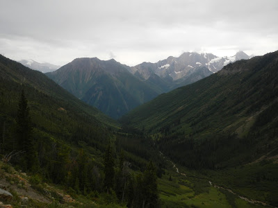
The photos will do a better job of explaining this than I ever could. The Basin is a big valley leading more or less straight up to Black Diamond Mountain. Once in the Basin we could see our destination (or what we thought was the destination since we didn't know 100% where we were... as per usual).
O'er the Hills
Mountain Flowers
Black Diamond Basin
Mini Glacier
Adam feat. Mini Glacier
Me feat. Mini Glacier
Over and Under Glacier
Into the Abyss
Up the basin, through gorgeous glades, and forests, and little plateaus, and over streams, and up into the alpine. Gorgeous. Amazing. All round breath taking.
Alpine Bloom
Spots
Bloom
Vibrance
The Last Survivor
Black Diamond Basin
Still Climbing
Where Trees Can't Grow
Adam feat. the World
Black Diamond Peak
Nearing the peak we had two choices... left, or right. If we ascended on the right we would end up looking down Delphine Creek... if we ascended on the left we would get views of the Commander Glacier. We wanted to see the glacier, though both ascents appeared rather... challenging... from a scrambling point of view.
We picked a bearing (left) and got to it.
Sitting on the Scree
Adam feat. Scree of Death
Monument Peak
It was challenging... scree... nasty... unmanageable... scree.
Stegosaurus Rock
Me
Adam on Top of the World!
The Top Not Top Top
The Wide Basin
Spin
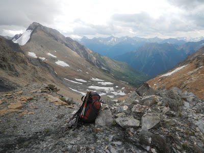
We managed it. It took some time, but we did it. We climbed the scree as far as we could, and then climbed a rock that we dubbed Stegosaurus Rock (due to its shape). We climbed, and climbed, and climbed, and made it to what I would call the shoulder of Black Diamond Mountain. The remaining hundred metres to the actual peak seemed a bit... dangerous for not having climbing gear or experience... and the view we already had was astounding. We could see down the Black Diamond Basin on one side, and other the other we could see the Commander Glacier, as well as the Farnham Creek Road (which actually almost came right to the top on the other side!!!).
Geat feat. Epic
In the Basin
Ice
We rested a bit, enjoyed the view, and began the climb back down.
Down Stegosaurus Rock
Rest on the Rocks
The Hump
We climbed. We screeed. We passed back through the Basin. Past some rather fresh bear poo. And back down down down to Ruby.
Life on Ice
Through the Frost
Back Down
Bits
Meadow
Survived
It was amazing. I'll confess. I was tired, and sore, and didn't know if I would be able to walk the next day... but it was amazing!


No comments:
Post a Comment